Code: P23192
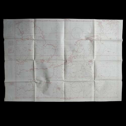
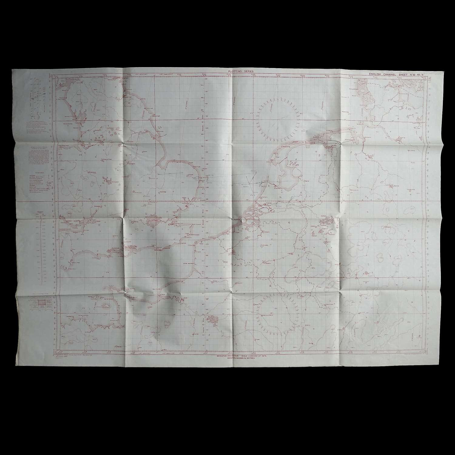
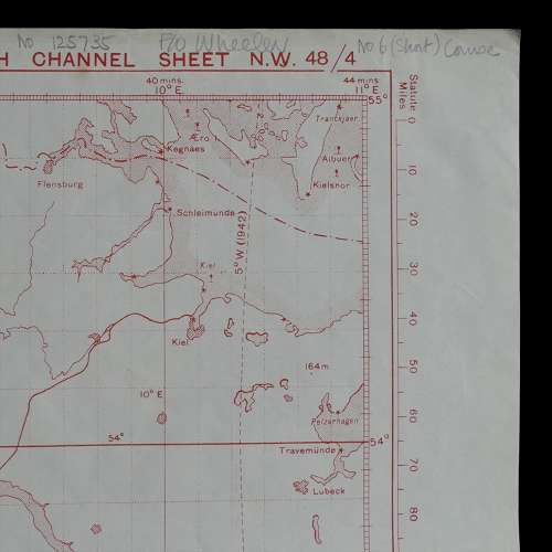
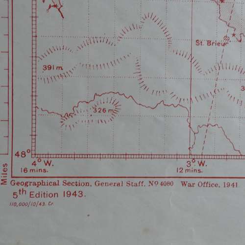
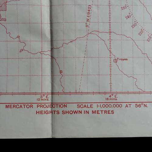
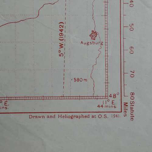
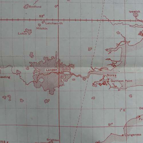
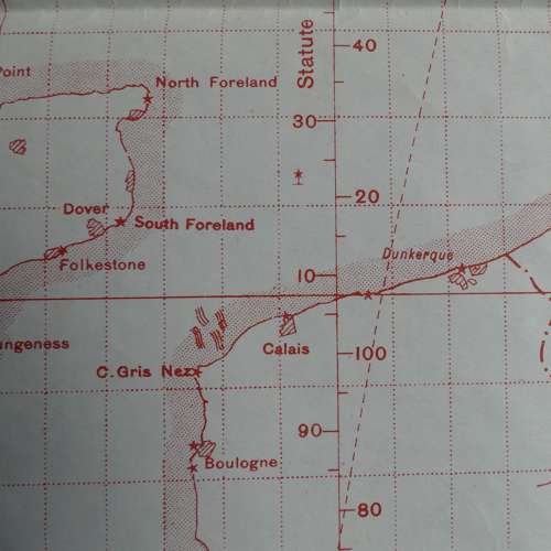
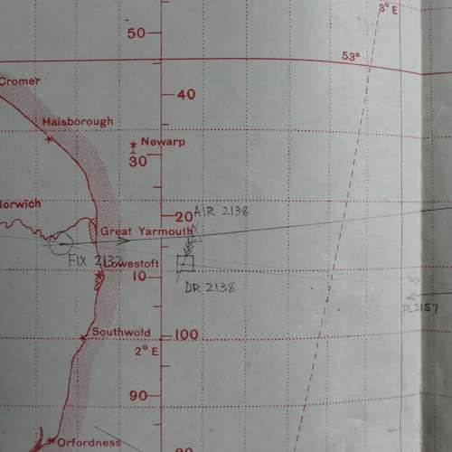
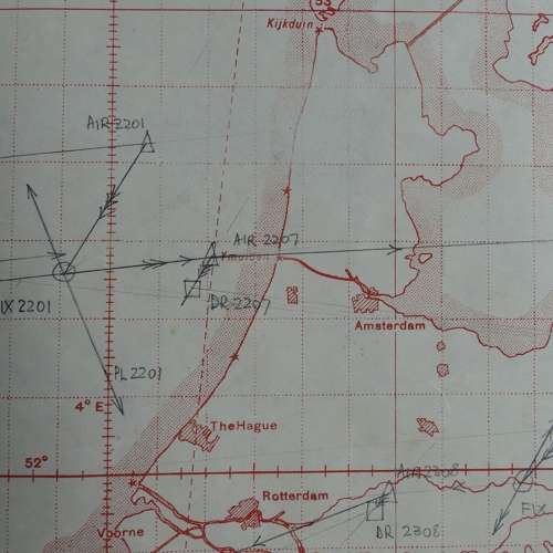
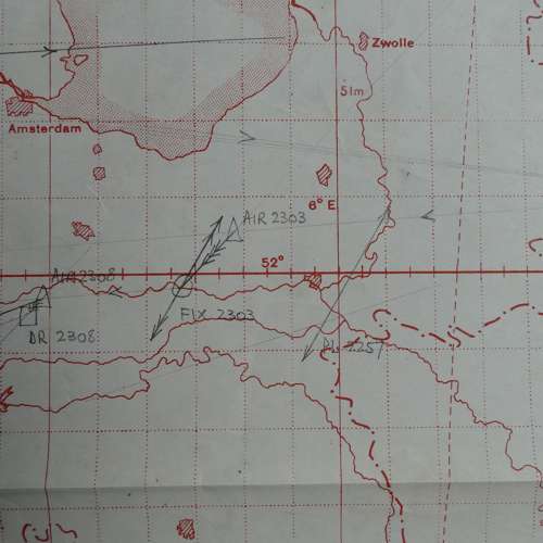
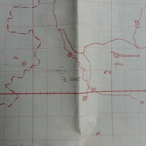
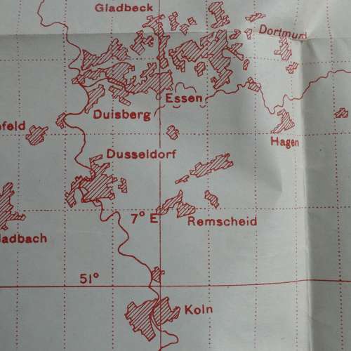
RAF Plotting Series Map, Sheet N.W. 48/4. English Channel. Scale 1 : 1,000,000 at 56 degrees North. Printed on paper. Approximately 110 x 76cm. Drawn and heliographed at O.S. 1941, published by the War Office in 1941, this 5th edition printed in October 1943. Shows much of England & Wales, the English Channel and coastline of France, Holland, Belgium and Denmark. Also large sections of Western Europe. Marked by a Flying Officer Wheeler with a flight route/sortie from England to Germany and back. A little dog eared at the edges/corners with some creasing but generally clean and in good to very good used condition. Folded. Will be sent folded unless otherwise requested (can be sent rolled at extra cost). These maps are very popular and increasingly difficult to find. Stock code P23192.