


Code: P24509
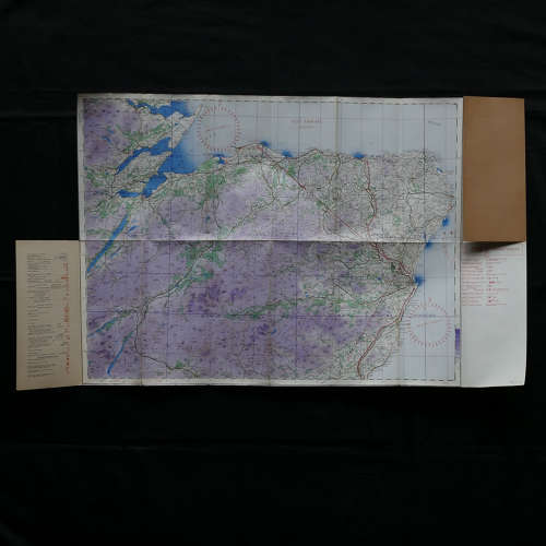
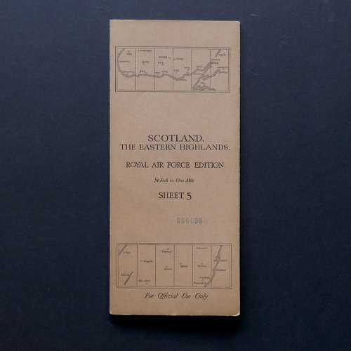
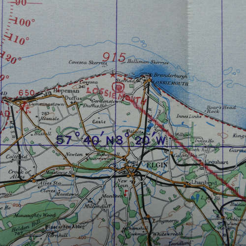
Scotland, The Eastern Highlands, Royal Air Force Edition. Sheet 5, 1939 dated. 1/4" to One Mile. Linen backed paper with card covers. Approximately 102 x 54cm. Shows wartime air bases operational at the time including Kintore, Aberdeen, and Inverness. Lossiemouth & Kinloss have been added in chinagraph pencil along with a flight route. Folded/creased. Very light soiling. Excellent used. Stock code P24509.