
Code: P24215A-106
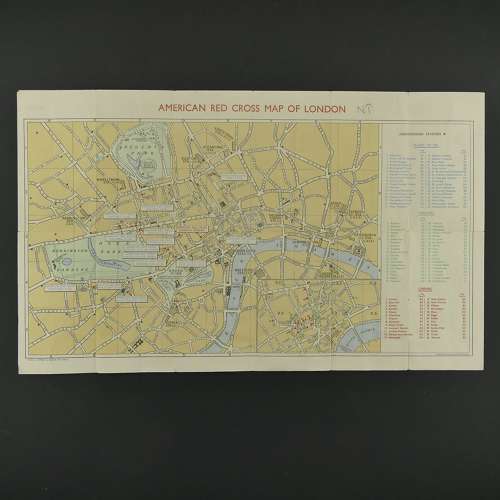
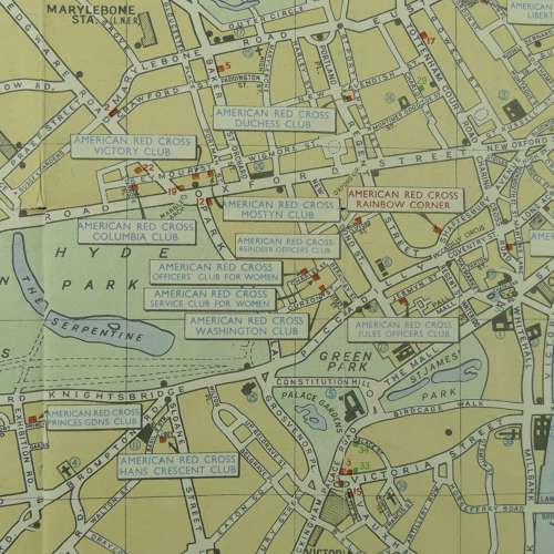
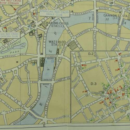
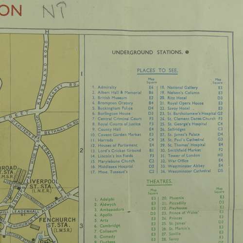
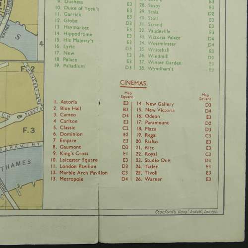
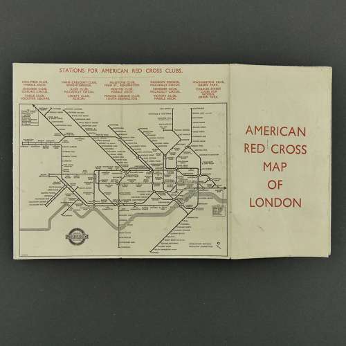
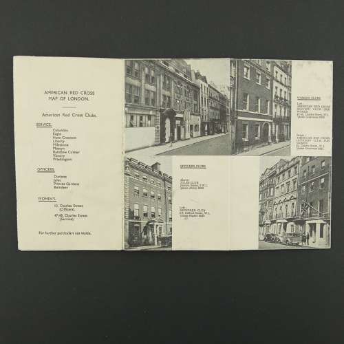
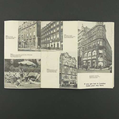
Approximately 8.5 x 15cm folded and 50 x 30cm when opened out. A handy wartime pocket guide to London that includes a tube map and details of the various American Red Cross clubs across the capital. When opened out there is a useful colour map of central London (3"-mile). A bit crumpled, lightly soiled and with a few small edge tears. Stock code P24215A-106.